Zealandia Explained: Earth's Hidden Eighth Continent
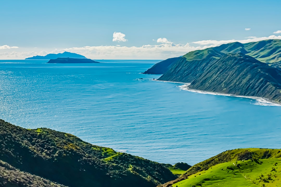
Ninety-four percent of Zealandia sits beneath the Pacific Ocean, which is exactly why it took geologists until 2017 to formally argue it deserves the label 'continent.' It was always there — a landmass roughly the size of greater India — hiding in plain sight beneath roughly 2 kilometers of seawater. The sliver that pokes above the surface? That's New Zealand and New Caledonia. The rest is submerged, and that single fact scrambled decades of assumptions about how many continents Earth actually has.
What Is Zealandia? A Plain-Language Definition
More Than Just Sunken Land
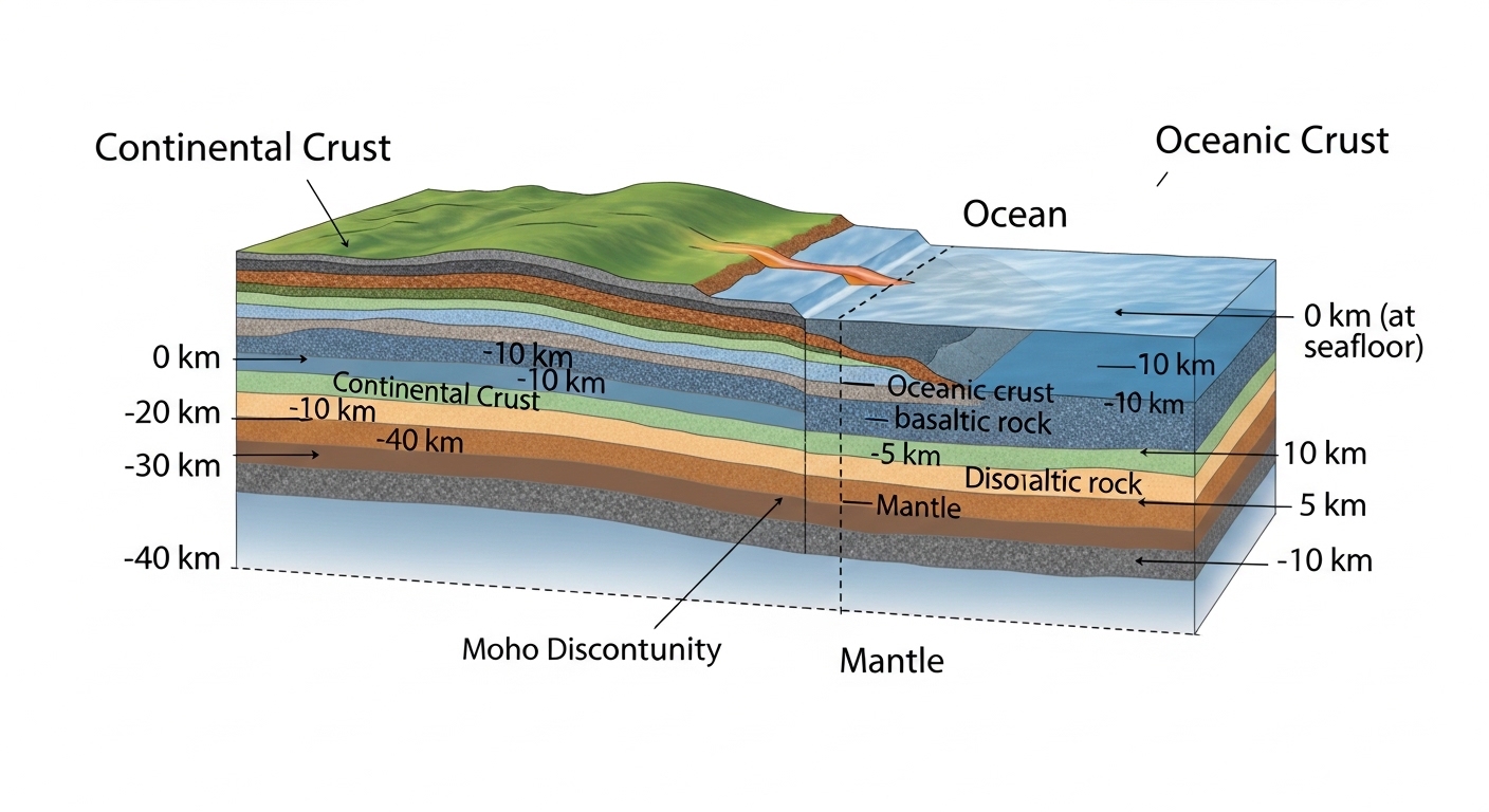
Not every chunk of submerged rock qualifies as a continent. Zealandia passes the test because it meets the same geological criteria used for the seven continents most of us learned in school: it has a distinct crustal type (continental crust, not oceanic crust), it sits elevated above the surrounding ocean floor, and it has well-defined geological boundaries. Oceanic crust is dense and thin — typically around 7 kilometers thick. Zealandia's crust runs 20 to 40 kilometers thick in places, which is the continental signature geologists look for.
The formal case was made in a 2017 paper published in the journal GSA Today by a team of geoscientists from New Zealand, Australia, and New Caledonia. They weren't discovering something new so much as reframing something that had been studied piecemeal for decades. The data had been accumulating since the 1990s; what changed was the willingness to synthesize it and make the continental argument explicitly.
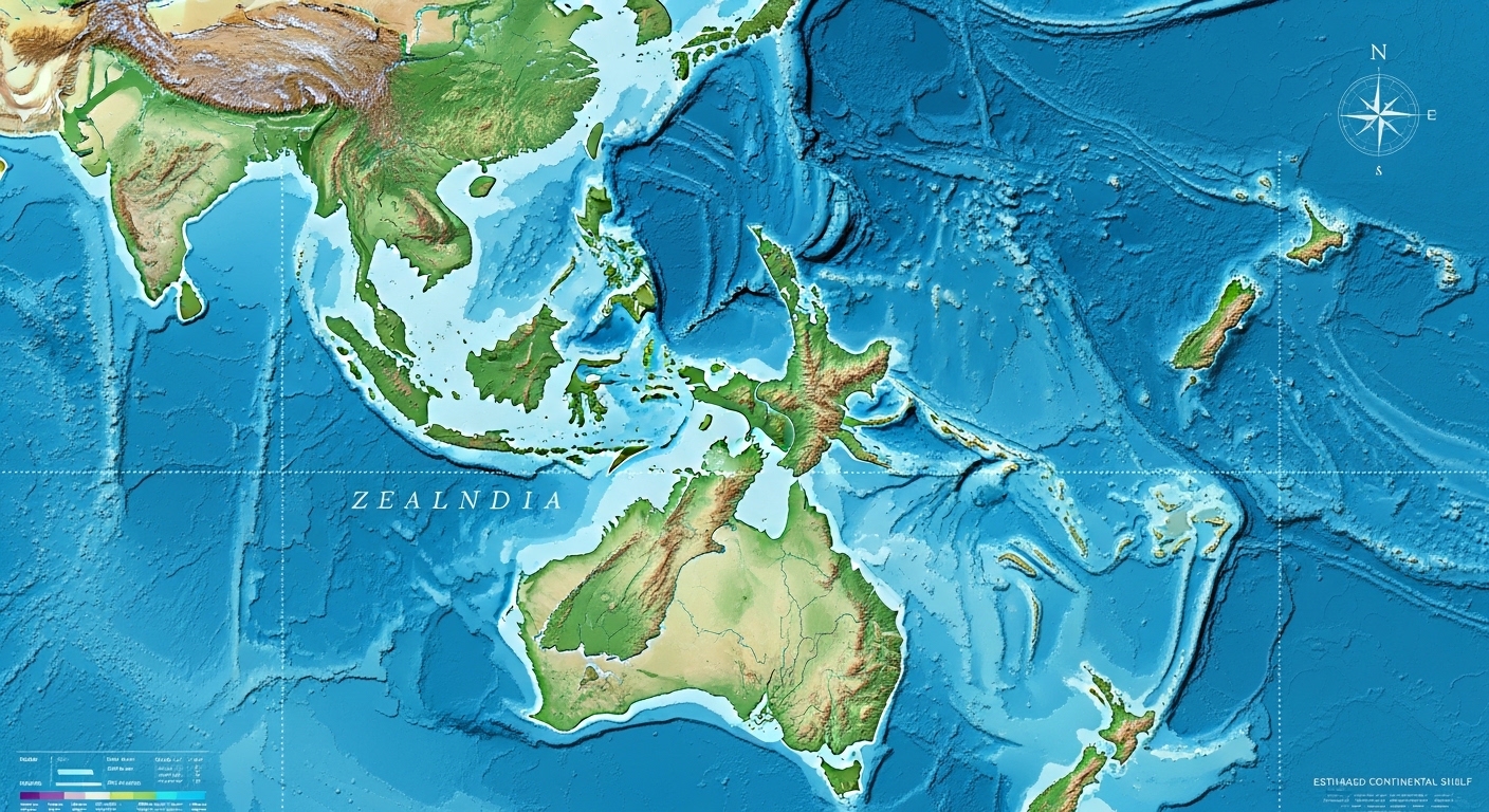
Zealandia covers an estimated 4.9 million square kilometers — making it both the smallest and the thinnest continent on Earth. It's also the youngest, having rifted away from the supercontinent Gondwana roughly 85 million years ago.
How Did Zealandia Form — and Why Did It Sink?
The Gondwana Breakup
Around 85 million years ago, the landmass that would become Zealandia began pulling away from what is now Antarctica and Australia. This wasn't a sudden crack — continental rifting is a slow, grinding process that unfolds over tens of millions of years. As Zealandia separated, the crust stretching between it and the rest of Gondwana thinned dramatically. Thin crust is less buoyant. Zealandia gradually subsided.
By roughly 23 million years ago, most of the continent was underwater. The timing matters: this means Zealandia spent a long stretch of Earth's history as a largely isolated, mostly submerged landmass, which had profound consequences for the life that evolved on the parts that stayed above water. New Zealand's famous lack of native land mammals — aside from bats — is a direct result of that isolation.
Why It Didn't Disappear Entirely
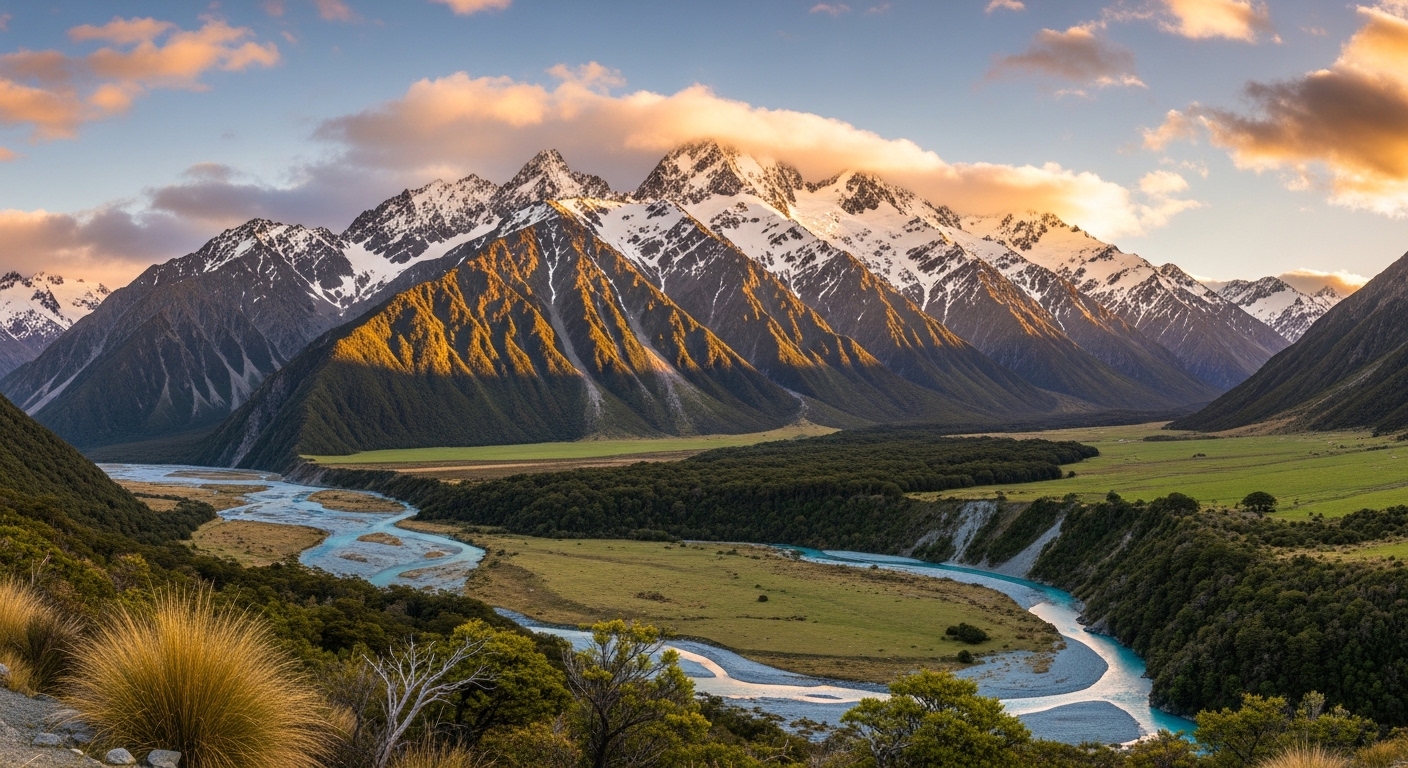
The reason any of Zealandia remains above sea level today comes down to the Pacific-Australian tectonic plate boundary, which runs directly through New Zealand. The collision and subduction along this boundary pushed parts of the crust back upward, creating the Southern Alps and keeping the islands above water. Without that ongoing tectonic activity, New Zealand itself might have vanished beneath the waves millions of years ago.
Zealandia didn't sink because it was geologically weak — it sank because rifting stretched and thinned it. The distinction matters enormously for how we classify it.
How Scientists Mapped a Continent Underwater
The Tools That Made It Possible
Mapping Zealandia required technology that simply didn't exist at the right resolution until relatively recently. Multibeam sonar — which sends out a fan of sound pulses from a ship's hull and measures the return time across a wide swath of seafloor — allowed researchers to build detailed bathymetric maps of the ocean bottom around New Zealand and New Caledonia. Satellite altimetry added another layer: tiny variations in sea surface height reflect the gravitational pull of underwater topography, giving scientists a rough continental outline from space.
Drilling is where things get really specific. The International Ocean Discovery Program (IODP) conducted expeditions to drill into Zealandia's submerged crust, pulling up core samples that revealed something unexpected: ancient pollen, spores, and the remains of shallow-water organisms. This told geologists that parts of Zealandia that are now 1,000 meters underwater were once close to or at the surface — a finding that reshaped understanding of how dramatically the continent had subsided and then partially re-elevated over geological time.
The Surprisingly Tricky Question of Boundaries
One operational detail that rarely makes it into popular coverage: defining where Zealandia ends and the surrounding oceanic crust begins required drawing a line through gradational zones where crust type changes gradually rather than abruptly. Geologists used a combination of crustal thickness measurements, seismic data, and gravity anomaly maps to draw the boundary. It's a judgment call backed by data — not a crisp edge you could trace with a ruler.

Why Zealandia's Recognition Changes More Than Just the Continent Count
Implications for Geology and Plate Tectonics
Recognizing Zealandia as a continent isn't just a taxonomic upgrade. It forces a rethink of how continental crust behaves under extreme thinning — Zealandia's crust is far thinner than any other continent's, which makes it a natural laboratory for studying the boundary conditions of what 'continent' even means physically. Some researchers argue that studying Zealandia could refine models of how ancient supercontinents like Gondwana and Pangaea broke apart.
A continent that is 94% submerged is essentially a stress test for every definition of 'continent' we've ever used.
There are also legal and resource implications. Under the United Nations Convention on the Law of the Sea (UNCLOS), a country's continental shelf can extend its exclusive economic zone beyond the standard 200 nautical miles if the seafloor is a natural prolongation of its land territory. New Zealand has already submitted claims based on Zealandia's extent. The geology directly affects sovereign rights over potential seabed resources.
What It Means for Biodiversity Research
Zealandia's long isolation — and the periodic flooding and partial re-emergence of its landmass — created conditions unlike anywhere else on Earth. New Zealand's tuatara, a reptile with no close living relatives, is a survivor from a lineage that dates back over 200 million years. The weta, a large insect that fills ecological niches normally occupied by small mammals, exists in part because there were no small mammals to compete with. Zealandia's geological history is inseparable from its biological history.
(Opinion: The 2017 reclassification felt overdue. The data had been sitting in geological surveys for years, and the reluctance to call Zealandia a continent seemed more like institutional inertia than scientific caution. Sometimes the map really does need updating.)
Frequently Asked Questions
Is Zealandia officially recognized as a continent by all scientists?
The 2017 paper made a compelling case, and it's widely cited and accepted among geoscientists who study the region. However, there's no single international body that officially certifies continents — the definition of 'continent' has always been somewhat fluid and varies by country and educational tradition. Most geologists working in the field treat Zealandia as a continent; school textbooks are slower to catch up.
Could sea levels ever drop enough to expose most of Zealandia?
Not through any realistic sea level change driven by ice ages. Even at the lowest sea levels during glacial maxima — estimates suggest the ocean dropped roughly 120 meters below current levels — only a modest additional portion of Zealandia would have been exposed. The bulk of the continent sits 1,000 to 2,000 meters below the surface. Exposing it would require tectonic uplift on a massive scale, not just a drop in sea level.
Why didn't geologists identify Zealandia as a continent much earlier?
The short answer is that most of it is underwater and hard to study. Early ocean floor mapping lacked the resolution to distinguish continental from oceanic crust with confidence across the entire region. The data accumulated gradually across separate research programs that weren't initially synthesized into a single continental argument. It's a good reminder that scientific classification sometimes lags behind the evidence simply because no one has yet done the work of pulling it all together.
Zealandia sits there right now, mostly dark and cold and two kilometers down, while the arguments about what to call it play out in journals and classrooms on the sliver of it that's still above water. The continent didn't change when we reclassified it. What changed was our willingness to see what the data had been showing us all along — and that gap between evidence and recognition is probably the most interesting thing about it.


Comments
Post a Comment